Obuasi
Highlights
- Pelangio has drilled 129 diamond drill holes for a total of 27,883 metres ranging in length up to 602 metres and averaging approximately 200 metres
- Drilling has lightly tested targets in eight general areas, with more than 85% of the drilling in the western half of the property
- The presence of an extensive gold system is illustrated by the fact that anomalous gold intercepts appear at nearly every prospect tested via drilling across the property
- Technical interpretation of data generated by these programs identify mineralization processes consistent with that observed at the neighbouring Obuasi Mine
- Obuasi style mineralization appears on Pelangio’s ground in multiple occurrences across the property from a variety of geological and structural settings
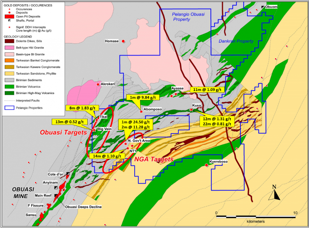
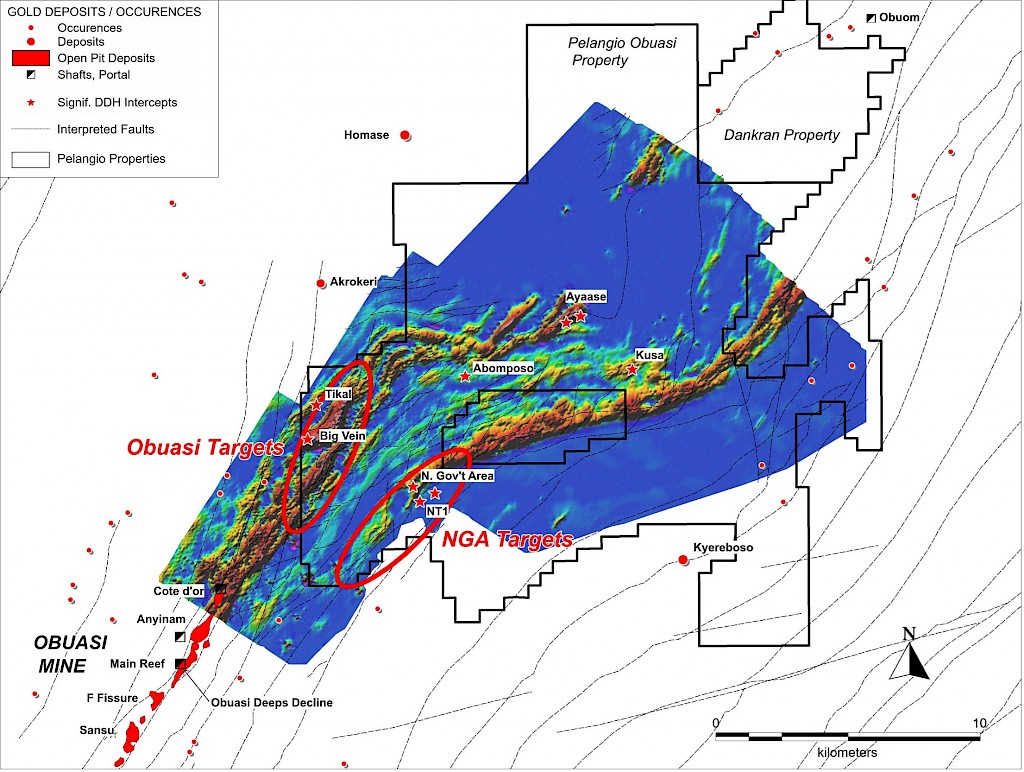
- Recent data compilation and reanalysis conducted by Pelangio have identified two primary target areas in the western half of the property which will be subject to future drill testing, including:
- The Obuasi Targets, an extension of the deposit host geology and related structures from the Obuasi Mine into the western edge of Pelangio’s project area; and
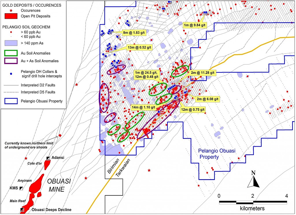
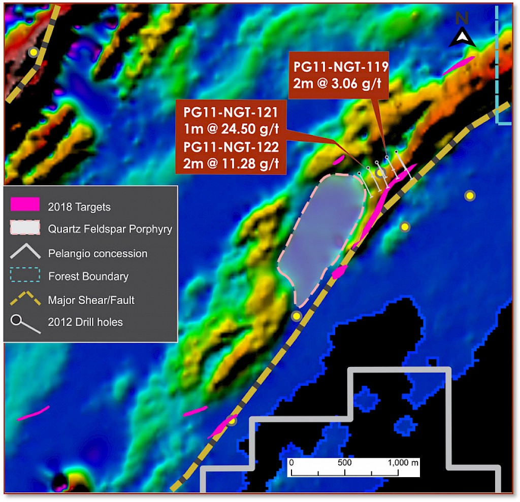
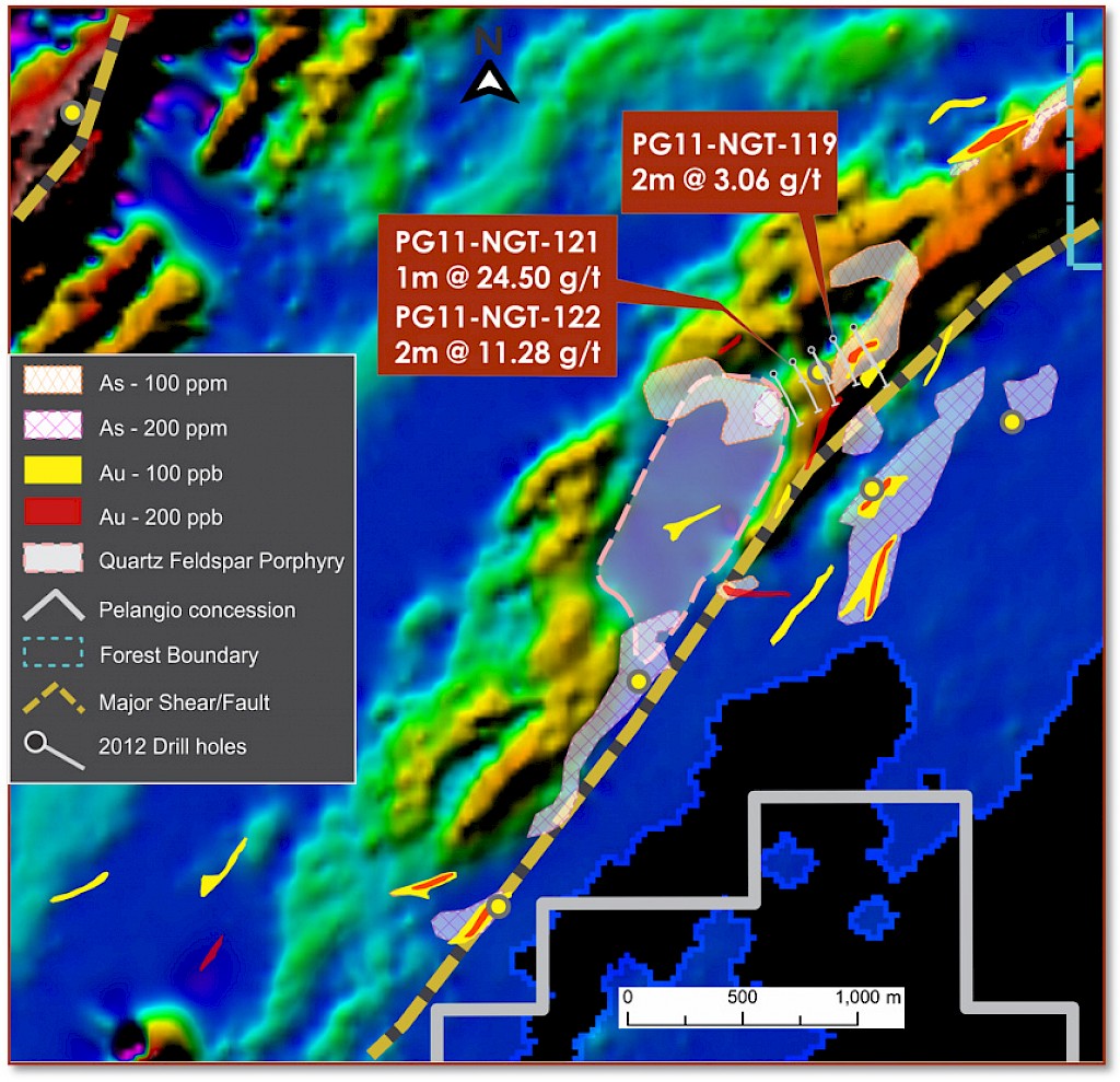
- The NGA (North Government Area) Targets along and close to the main Birimian / Tarkwaian contact, including one prospect on which Pelangio returned two high grade drill intercepts of 1m of 24.50 g/t gold and 2m of 11.28 g/t gold, with very limited drill follow up
Ownership
- 100% owned
- 284 square kilometres on the Ashanti Gold Belt
Property Details
The Obuasi property is located contiguous with AngloGold Ashanti's world-class Obuasi gold mine within the prolific 300-kilometre-long Ashanti Gold Belt in southwest Ghana, West Africa. The Obuasi mine has produced over 33 million ounces of gold since 1897 and currently hosts a resource of 29.5 million ounces of gold at an average grade of 7.64 g/t including a Proved and Probable Reserve of 8.73 million ounces of gold at an average grade of 8.62 g/t. (Source: AngloGold Ashanti Mineral Resource and Ore Reserve Report 2020).
Pelangio’s most recent drilling campaign discovered high-grade, vein–hosted visible gold mineralization in sheared graphitic argillites, the typical ore host at the Obuasi Mine. The structural characteristics of the Obuasi Mine’s mineralization consists of shear hosted quartz vein mineralization located within graphitic structures in Birimian sediments (wackes and phyllites) and along their contacts with Birimian volcanics and more competent Tarkwaian sediments. Quartz vein hosted gold at Obuasi is generally “free” gold (non-refractory) and usually high grade. Gold also occurs in silicified alteration haloes around the veins and is associated with fine needles of arsenopyrite. This style of gold is refractory, with gold encapsulated by arsenopyrite grains, and is usually lower grade but tends to develop into wide zones of mineralization. Pelangio’s Obuasi property contains evidence of both styles of mineralization; quartz (+/- carbonate) veining in carbonaceous shear zones in the sediments and locally within mafic volcanics (e.g. at Big Vein) with locally high grades (e.g. the NGA prospect) and also zones of silicification within the sediments, volcanics and dioritic intrusives (e.g. at Kusa) with disseminated arsenopyrite +/-pyrite and elevated gold grades.
A soil sampling campaign conducted post drilling discovered seven areas with greater than 200 ppb gold between 200 metres to 800 metres in strike length. Given the size of the land package Pelangio is exploring, it is the Company’s evidenced opinion that the drilling and exploration programs completed on the Obuasi project have thus far just scratched the surface of the property’s geology. When one considers the target model (a several million oz high grade lode sourced from the massive fluid system that deposited >60Moz a few kilometres to the southwest) further exploration and drilling on the project is demonstrably justified. Robust geological study over the course of Pelangio's interest in the property concludes that numerous D2 anastomosing splay structures emanate from the Obuasi Main Reef Fissure and strike north-easterly into Pelangio’s property. In addition, multiple north-north-east striking D5 structures, comparable to the Obuasi Main Reef Fissure, have been interpreted across Pelangio’s property. Anyone of these structures has the potential to have channeled mineralized fluids from the Obuasi Mine property with the deposition of a sizeable lode of gold mineralization in a suitable structural trap on Pelangio’s ground. Ongoing data reanalysis and reinterpretation is developing a ranked series of compelling targets for further drill testing.
For further information on the Obuasi property, please see the technical report, “Independent Technical Report, Obuasi Gold Project, Obuasi, Ghana for Pelangio Mines Inc. and Pelangio Exploration Inc. by SRK Consulting (Canada) Inc.”, April 30, 2008
Obuasi Project 3D Animation